


Dataset
Luftbildplan 1961 Wien
| Maintainer | Magistrat Wien - Magistratsabteilung 41 - Stadtvermessung |
|---|---|
| Maintainer Link | https://www.wien.gv.at/kontakte/ma41/index.html |
| Maintainer Email | ogd@ma41.wien.gv.at |
| Publisher | Stadt Wien |
| Publisher Link | https://digitales.wien.gv.at |
| Publisher Email | open@post.wien.gv.at |
| License | Creative Commons Namensnennung 4.0 International (CC BY 4.0) |
| License Citation |
Datenquelle: Stadt Wien - https://data.wien.gv.at |
| Terms URL | https://data.wien.gv.at/nutzungsbedingungen |
| Metadata Link | https://digitales.wien.gv.at/open-data/geowebservices/ https://www.data.gv.at/infos/geowebservices-potenzial-besser-nutzen/ |
| Geographic Toponym | Wien |
| Geographic Bounding Box | WGS84: POLYGON ((16.577511 48.322571, 16.18218 48.117668)) |
| Beginning Date/Time | September 1, 1961, 01:00 (+0100) |
| End Date/Time | September 1, 1961, 01:00 (+0100) |
| Update Frequency | nicht geplant |
| Lineage Quality | Luftbildbefliegung 1. September 1961, Schwarz-Weiß-Bilder, Auflösung 25 cm |
| Schema Name | OGD Austria Metadata 2.6 |
| Schema Language | ger |
| Schema Characterset | utf8 |
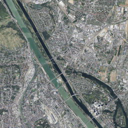
| Resource title and description in English | **Aerial Image Catalogue 1961 Vienna** The Vienna aerial image catalogue from the year 1961 covers the entire city area. The pixel size oft the black and white aerial images is 25 centimetres. They were taken on September 1st, 1961. https://www.wien.gv.at/stadtentwicklung/stadtvermessung/service/luftarchiv.html |
| ID | 1c59dbe1-9813-42fa-a343-b1d3b71085ee |
| Human readable URL | https://www.data.gv.at/katalog/en/dataset/luftbildplan-1961-wien |
-
Details
Field Value Metadata last updated February 11, 2025 Data Format HTML License Creative Commons Namensnennung 4.0 International (CC BY 4.0) Data Identifier 6ddc9199-8f4e-47ca-882e-931739236b60 Metadata Identifier 1c59dbe1-9813-42fa-a343-b1d3b71085ee Data URL https://www.wien.gv.at/geodatenviewer/portal/wien/ -
Details
Field Value Metadata last updated February 11, 2025 Data Format JPEG License Creative Commons Namensnennung 4.0 International (CC BY 4.0) Data Identifier ed58f146-d1b3-480b-9e40-e744a19eab7f Metadata Identifier 1c59dbe1-9813-42fa-a343-b1d3b71085ee Data URL https://www.wien.gv.at/ma41datenviewer/downloads/geodaten/lb_img/35_4_lb1961.zip -
Details
Field Value Metadata last updated February 11, 2025 Data Format JPEG License Creative Commons Namensnennung 4.0 International (CC BY 4.0) Data Identifier d6ececd9-322c-4056-aa40-944e269a4c88 Metadata Identifier 1c59dbe1-9813-42fa-a343-b1d3b71085ee Data URL https://mapsneu.wien.gv.at/wmts/lb/farbe/google3857/12/1419/2234.jpeg -
Details
Field Value Metadata last updated February 11, 2025 Data Format wmst License Creative Commons Namensnennung 4.0 International (CC BY 4.0) Data Identifier 480f64f7-505e-4ef6-987c-f42e7c733946 Metadata Identifier 1c59dbe1-9813-42fa-a343-b1d3b71085ee Data URL https://mapsneu.wien.gv.at/wmtsneu/1.0.0/WMTSCapabilities.xml
Did you create an application for this data set? Please let us know if you did.