


Datensatz
Luftbildplan 1971 Wien
| Datenverantwortliche Stelle | Magistrat Wien - Magistratsabteilung 41 - Stadtvermessung |
|---|---|
| Kontaktseite der datenverantwortlichen Stelle | https://www.wien.gv.at/kontakte/ma41/index.html |
| Datenverantwortliche Stelle - E‑Mailkontakt | ogd@ma41.wien.gv.at |
| Veröffentlichende Stelle | Stadt Wien |
| Kontaktseite der veröffentlichenden Stelle | https://digitales.wien.gv.at |
| Veröffentlichende Stelle - E‑Mailkontakt | open@post.wien.gv.at |
| Lizenz | Creative Commons Namensnennung 4.0 International (CC BY 4.0) |
| Lizenzzitat |
Datenquelle: Stadt Wien - https://data.wien.gv.at |
| Link zu den Nutzungsbedingungen | https://data.wien.gv.at/nutzungsbedingungen |
| Weiterführende Metadaten - Link | https://digitales.wien.gv.at/open-data/geowebservices/ |
| Geographische Abdeckung/Lage | Wien |
| Geographische Ausdehnung | WGS84: POLYGON ((16.577511 48.322571, 16.18218 48.117668)) |
| Zeitliche Ausdehnung (Anfang) | Mai 14, 1971, 01:00 (MEZ) |
| Zeitliche Ausdehnung (Ende) | Mai 16, 1971, 01:00 (MEZ) |
| Aktualisierungszyklus | nicht geplant |
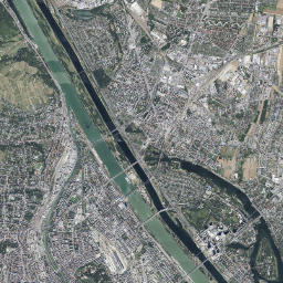
| Datenqualität/Herkunft | Luftbildbefliegung 14. und 16. Mai 1971, Schwarz-Weiß-Bilder, 25 cm Auflösung |
| Bezeichnung der Metadatenstruktur | OGD Austria Metadata 2.6 |
| Sprache des Metadatensatzes | ger |
| Character Set Code des Metadatensatzes | utf8 |
| Titel und Beschreibung Englisch | **Aerial Image Catalogue 1971 Vienna** The Vienna aerial image catalogue from the year 1971 covers the entire city area. The pixel size oft the black and white aerial images is 25 centimetres. They were taken on Mai 14th an Mai 16th, 1971. https://www.wien.gv.at/stadtentwicklung/stadtvermessung/service/luftarchiv.html |
| Eindeutiger Identifikator | a6cd7b34-a83a-4418-95ca-248726c70cb9 |
| Menschenlesbare URL | https://www.data.gv.at/katalog/de/dataset/luftbildplan-1971-wien |
-
Details
Feld Wert Metadaten zuletzt aktualisiert 10. Juni 2024 Datensatz, Dienst oder Dokument Format HTML Lizenz Creative Commons Namensnennung 4.0 International (CC BY 4.0) Eindeutiger Identifier Datensatz, Dienst oder Dokument c08a6d70-915c-4df5-9ec2-bff34be2d3fa Eindeutiger Identifier Metadatenblatt a6cd7b34-a83a-4418-95ca-248726c70cb9 URL zu Datensatz, Dienst oder Dokument https://www.wien.gv.at/geodatenviewer/portal/wien/ -
Details
Feld Wert Metadaten zuletzt aktualisiert 10. Juni 2024 Datensatz, Dienst oder Dokument Format JPEG Lizenz Creative Commons Namensnennung 4.0 International (CC BY 4.0) Eindeutiger Identifier Datensatz, Dienst oder Dokument 9ec4de20-f3a6-4615-ab2b-1cf023f16986 Eindeutiger Identifier Metadatenblatt a6cd7b34-a83a-4418-95ca-248726c70cb9 URL zu Datensatz, Dienst oder Dokument https://www.wien.gv.at/ma41datenviewer/downloads/geodaten/lb_img/35_4_lb1971.zip -
Details
Feld Wert Metadaten zuletzt aktualisiert 10. Juni 2024 Datensatz, Dienst oder Dokument Format JPEG Lizenz Creative Commons Namensnennung 4.0 International (CC BY 4.0) Eindeutiger Identifier Datensatz, Dienst oder Dokument d1d40f3a-85b5-4bb1-9024-523fe4fd48ab Eindeutiger Identifier Metadatenblatt a6cd7b34-a83a-4418-95ca-248726c70cb9 URL zu Datensatz, Dienst oder Dokument https://mapsneu.wien.gv.at/wmts/lb/farbe/google3857/12/1419/2234.jpeg -
Details
Feld Wert Metadaten zuletzt aktualisiert 10. Juni 2024 Datensatz, Dienst oder Dokument Format wmst Lizenz Creative Commons Namensnennung 4.0 International (CC BY 4.0) Eindeutiger Identifier Datensatz, Dienst oder Dokument d1db334e-4c9f-4e1f-9529-7f2bbc97f49a Eindeutiger Identifier Metadatenblatt a6cd7b34-a83a-4418-95ca-248726c70cb9 URL zu Datensatz, Dienst oder Dokument https://mapsneu.wien.gv.at/wmtsneu/1.0.0/WMTSCapabilities.xml
Haben Sie eine Anwendung zu diesem Datensatz erstellt? Dann teilen Sie uns dies bitte mit.