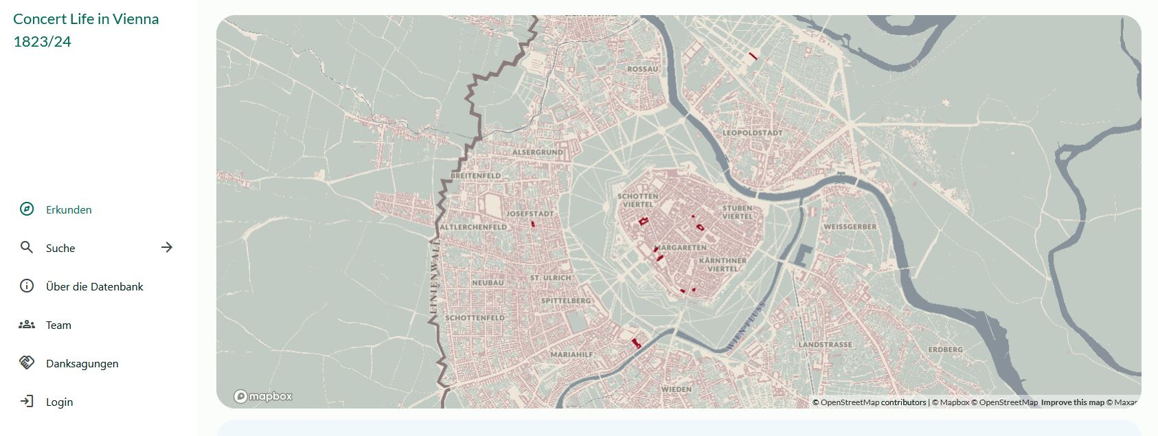
This website presents the results of the ongoing WEAVE research project “Concert Life in Vienna, 1780–1830,” which is supported by the Austrian Science Fund (FWF) and the German Research Foundation (DFG). The task of the project is to document all known concerts that occurred during this epoch-making half century. This means consolidating, checking, and standardizing all previously known data on the relevant events, venues, works, persons, and institutions as well as seeking out new data in archival and other sources. Our goal is to present this data in such a way that a wide variety of users can find the information they need intuitively, while the sources for this information are transparent and easily accessible. The colorful array of performers, repertoire, and performance spaces in Viennese concert life naturally awakens curiosity as to where these events took place. The web database makes this cultural topography palpable to the user with a newly designed digital map based on historical maps and address books of the period. The current base map of Vienna is based on the “Franziszeischer Kataster,” a detailed land-use map compiled between 1817 and 1829. The Concert Life Cartography team has adapted a digitized, georeferenced version by the Stadtarchäologie Wien, to which they have added a street grid and historical street and neighborhood labels. The map you see, represents the latest state of the city in our period of study. As the Concert Life database expands, earlier stages of the city map will be added as well. More information on the project can be found at https://musikwissenschaft.univie.ac.at/forschung/projekte/aktuelle-projekte/konzertleben-in-wien-1780-1830/