


Dataset
Orthofoto 2020 Wien
| Maintainer | Magistrat Wien - Magistratsabteilung 41 - Stadtvermessung |
|---|---|
| Maintainer Link | https://www.wien.gv.at/kontakte/ma41/index.html |
| Maintainer Email | ogd@ma41.wien.gv.at |
| Publisher | Stadt Wien |
| Publisher Link | https://digitales.wien.gv.at |
| Publisher Email | open@post.wien.gv.at |
| License | Creative Commons Namensnennung 4.0 International (CC BY 4.0) |
| License Citation |
Datenquelle: Stadt Wien - https://data.wien.gv.at |
| Terms URL | https://data.wien.gv.at/nutzungsbedingungen |
| Metadata Link | https://www.wien.gv.at/stadtentwicklung/stadtvermessung/geodaten/orthofoto/index.html https://www.data.gv.at/infos/geowebservices-potenzial-besser-nutzen/ |
| Geographic Toponym | Wien |
| Geographic Bounding Box | WGS84: POLYGON ((16.577511 48.322571, 16.18218 48.117668)) |
| Beginning Date/Time | July 30, 2020, 02:00 (+0200) |
| End Date/Time | July 31, 2020, 02:00 (+0200) |
| Update Frequency | nicht geplant |
| Lineage Quality | Luftbildbefliegung 30.7.2020 und 31.7.2020; Auflösung 15 cm; https://www.wien.gv.at/stadtentwicklung/stadtvermessung/geodaten/orthofoto/index.html |
| Schema Name | OGD Austria Metadata 2.6 |
| Schema Language | ger |
| Schema Characterset | utf8 |
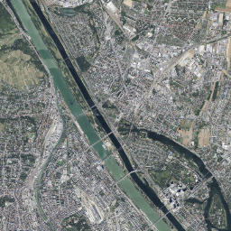
| Resource title and description in English | **Orthofoto 2020 Vienna** The Vienna orthophoto from the year 2020 covers the entire city area with a pixel size of 15 centimeters. The aerial images were taken on 30th and 31th of July 2020. https://www.wien.gv.at/stadtentwicklung/stadtvermessung/geodaten/orthofoto/index.html |
| ID | a766b57e-aefd-41c7-957f-2de3c233d5b8 |
| Human readable URL | https://www.data.gv.at/katalog/en/dataset/orthofoto-2020-wien |
-
Details
Field Value Metadata last updated February 11, 2025 Data Format HTML License Creative Commons Namensnennung 4.0 International (CC BY 4.0) Data Identifier 10ece35e-1049-4341-9c4e-ea0e6dbfd7b2 Metadata Identifier a766b57e-aefd-41c7-957f-2de3c233d5b8 Data URL https://www.wien.gv.at/ma41datenviewer/public/start.aspx -
Details
Field Value Metadata last updated February 11, 2025 Data Format JPEG Data Size 39.9 MiB License Creative Commons Namensnennung 4.0 International (CC BY 4.0) Data Identifier 7a79f9b1-47f1-4b3f-9c43-a729342d3c25 Metadata Identifier a766b57e-aefd-41c7-957f-2de3c233d5b8 Data URL https://www.wien.gv.at/ma41datenviewer/downloads/geodaten/op_img/35_4_op_2020.zip -
Details
Field Value Metadata last updated February 11, 2025 Data Format JPEG License Creative Commons Namensnennung 4.0 International (CC BY 4.0) Data Identifier 1a33c465-eebe-4004-b109-9b2f1279698d Metadata Identifier a766b57e-aefd-41c7-957f-2de3c233d5b8 Data URL https://mapsneu.wien.gv.at/wmts/lb/farbe/google3857/12/1419/2234.jpeg -
Details
Field Value Metadata last updated February 11, 2025 Data Format wmst License Creative Commons Namensnennung 4.0 International (CC BY 4.0) Data Identifier bbb4c5c5-f3ba-4f0d-b8e2-0d0a436804ef Metadata Identifier a766b57e-aefd-41c7-957f-2de3c233d5b8 Data URL https://mapsneu.wien.gv.at/wmtsneu/1.0.0/WMTSCapabilities.xml