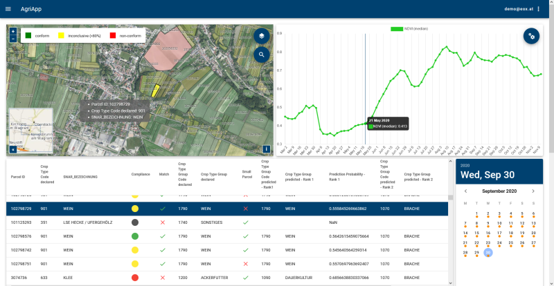
The EO-WIDGET project aimed at developing a robust technological chain linking EO data processed in cloud environments to a web interface that delivers the data and the results towards the end users. The Agri service platform integrates mini-applications providing visualization access to monitoring products and related quality assessments, while at the same time supporting expert judgment and user activities in a GIS environment. One of the key points is that the end-user platform presents real-time-processed EO signals, while the back-end processing can be distributed among several cloud locations and processing chains.
The Agri service platform is designed with full interoperability in mind, allowing
* to consume data products upstream from service providers of choice and
* to serve downstream APIs consumed by WebGUI applications like the AgriApp or by data-exchange logic to integrate with the Paying Agency's environment. Monitoring products from multiple sources can be sustained in the platform and analysed there for conformance and quality.
A monitoring product is the combination of EO signals, vegetation status indexes, spatial indicators and markers derived for a predefined group of declared parcels. The applied decision parameters are combined along the rules defined by the Paying Agencies. The app also offers to “look behind the algorithm”, by which it can become the user interface of fine tuning or setting the acceptance limits of automatized image processing.


